Stratigraphy và Ostracoda của Ripley Formation ở Western Georgia - Luận án của Raymond Weathers Stephens Jr
Luận án: Stratigraphy and ostracoda of the ripley formation of western geo. Xem tóm tắt và tải về tại LuanAn.net
Geology
Luan An
Luận án tiến sĩ
Năm xuất bản
Số trang
116
Thời gian đọc
18 phút
Lượt xem
0
Lượt tải
0
Phí lưu trữ
40 Point
Tổng quan nhanh
- Chủ đề:
- Ripley Formation Stratigraphy in Western Georgia
- Số trang:
- 116 trang
- Trường:
- Louisiana State University and Agricultural and Mechanical College
- Chuyên ngành:
- Geology
- Tác giả:
- Raymond Weathers Stephens Jr
- Năm:
- 1960
Tóm tắt nội dung luận án
I.Ripley Formation Stratigraphy in Western Georgia
This study examines the stratigraphy of the Ripley Formation within Western Georgia. Focus rests on understanding the geological succession and rock characteristics across specific counties. The Ripley Formation represents a significant Late Cretaceous deposit. Its distribution spans areas like Quitman, Stewart, Chattahoochee, Marion, Schley, Taylor, and Macon Counties. Investigation covers the region between the Flint and Ocmulgee Rivers. Geological mapping identifies distinct lithological units. Rock types provide insights into ancient depositional environments. Detailed stratigraphic columns document the sequence of sediments. This framework establishes a foundational understanding of the local Cretaceous geology. Such research contributes to regional geological knowledge. The Ripley Formation offers critical clues about past geological processes. Field observations complement laboratory analyses of rock samples. This comprehensive approach clarifies the formation's complex stratigraphy. Understanding these layers is essential for regional comparisons. The research defines the extent and nature of the Ripley Formation. It sets the stage for further paleontological investigations.
1.1. Regional Cretaceous Geology Overview
Western Georgia's Cretaceous geology features several significant formations. The Late Cretaceous period saw extensive marine transgressions. These events deposited thick sequences of clastic and carbonate sediments. The Ripley Formation constitutes a key part of this sedimentary record. It overlies older Cretaceous units and is overlain by younger Cenozoic deposits in some areas. Regional geological studies define the broader context for the Ripley Formation. Understanding these relationships aids in correlation across the southeastern United States. The Cretaceous system in Georgia provides evidence of a dynamic coastal plain environment. Paleogeographic reconstructions rely on detailed stratigraphic work. This study contributes precise data to that regional picture. Geological cross-sections illustrate the subsurface architecture. The overall Cretaceous framework is crucial for interpreting local depositional history. Regional patterns influence sediment supply and basin configuration. This overview situates the Ripley Formation within its broader geological setting.
1.2. Stratigraphic Units and Lithology
The Ripley Formation comprises various lithological units. These include sandstones, shales, and occasional limestones. Sediment composition varies across the study area. Quartz grains often dominate the sandstone fractions. Thin sections reveal mineral percentages and grain characteristics. Mean grain size and standard deviation of quartz grains are documented. Trace minerals also provide diagnostic information. Matrix descriptions complement rock textural analysis. Specific attention is given to the different facies present. These facies represent distinct depositional settings within the formation. Detailed descriptions differentiate between units like marine sands and deltaic silts. Lithological variations dictate the suitability for fossil preservation. Identification of key marker beds aids in correlation. The description of genera and species of ostracods also provides context within these units. The sedimentary characteristics are fundamental to paleoenvironmental interpretations. This detailed lithological analysis underpins all subsequent interpretations.
1.3. Depositional Environments of Ripley Formation
Interpreting depositional environments is central to stratigraphic studies. The Ripley Formation exhibits characteristics indicative of diverse settings. Evidence suggests a range from shallow marine to deltaic and possibly estuarine conditions. Sedimentological features, such as bedding structures and grain size, inform these interpretations. The presence of specific fossils, particularly ostracods, provides strong paleoecological clues. Ostracod assemblages vary with salinity, water depth, and substrate. This variation helps reconstruct ancient coastal plain and shelf environments. Changes in sea level significantly influenced these environments. Transgressive and regressive cycles shaped the depositional architecture. The area between the Flint and Ocmulgee Rivers shows particular environmental variability. Understanding these environments helps to predict sediment distribution. This work contributes to a more complete picture of Late Cretaceous paleogeography. The Ripley Formation records a complex interplay of marine and terrestrial influences. Reconstructing these environments offers insight into Earth's past climate systems.
II.Ostracoda Analysis Ripley Formation Micropaleontology
Micropaleontology forms a core component of this research. The study focuses on Ostracoda from the Ripley Formation. Ostracods are tiny crustaceans with bivalved shells. Their abundance and diversity make them excellent biostratigraphic and paleoenvironmental indicators. Hundreds of samples yield significant ostracod populations. Identification involves careful examination under microscopes. Specialists assist in verifying species identifications. The methodology ensures accurate taxonomic assignments. Ostracod illustrations facilitate detailed study and comparison. This extensive analysis builds a robust dataset. It helps understand past ecosystems and geological time. The distribution of ostracod species directly reflects environmental conditions. Micropaleontological research unlocks hidden details of the Late Cretaceous world. This approach provides fine-scale resolution for stratigraphic correlation. Ostracod studies are indispensable for Gulf Coastal Plain geology. The research adds significantly to the existing body of micropaleontological literature. It establishes a reference for future studies of Cretaceous Ostracoda.
2.1. Ostracod Fossil Collection and Identification
Fossil collection involves systematic sampling across the Ripley Formation. Samples are collected from various outcrops and stratigraphic intervals. Preparation of samples in the laboratory isolates the microfossils. This process typically includes disaggregation, washing, and sieving. Ostracod carapaces are then hand-picked under a binocular microscope. Over one hundred distinct ostracod samples provide the basis for this study. Identification relies on comparative morphology. Detailed features of the carapace, such as shape, ornamentation, and hinge structure, are critical. Comparison with established type collections confirms species assignments. The identification process is meticulous and time-consuming. Assistance from experts in ostracod taxonomy ensures accuracy. Each identified specimen contributes to the overall species checklist. This careful collection and identification form the foundation of the micropaleontological analysis. It ensures the reliability of all subsequent interpretations. The robust dataset supports comprehensive paleoecological and biostratigraphic analyses.
2.2. Key Ostracod Genera and Species
The Ripley Formation yields a diverse assemblage of Ostracoda. This study identifies numerous genera and species. Families represented include CYTHERELLIDAE, CYPRIDAE, BAIRDIIDAE, and CYTHERIDAE. Key genera like Cytherelloidea, Cytherella, Paracypris, Bairdoppilata, Xestoleberis, Loxoconcha, Cytheropteron, Orthonotacythere, Clythrocytheridea, Haplocytheridea, Krithe, Progonocythere, Brachycythere, Ptergocythere, Cythereis, Veenia, and Amphicytherura are present. Specific species such as Cytherelloidea crafti, Cytherella ovoidea, Bairdoppilata magna, Laxoconcha cretacaa, Haplocytheridea ? raybumensis, Haplocytheridea Barectaensis, Haplocytheridea ? ulrichi, Krithe cushmant, Cythereis costatana, Cythereis communis, Cythereis hazardi, and Cytherura ? aaratogana are documented. A new genus is also identified. The presence and relative abundance of these species characterize different stratigraphic levels. This detailed taxonomic work is crucial for biostratigraphic correlation. It provides a biological fingerprint for the Ripley Formation. The taxonomic descriptions clarify the diversity of Late Cretaceous life. This systematic approach contributes new knowledge about ostracod evolution.
2.3. Micropaleontological Techniques Utilized
Various micropaleontological techniques are employed. Standard methods include sample disaggregation using warm water and detergents. Wet sieving separates microfossils from bulk sediment. Picking trays and fine brushes aid in isolating individual ostracod carapaces. Scanning electron microscopy (SEM) imaging provides high-resolution views of morphological features. These images are critical for accurate identification and documentation. The study also uses techniques for preparing ostracod illustrations. Thin section analysis of the host rock helps understand the microenvironment of fossil preservation. This integrates paleontological findings with sedimentological data. Analysis of mineral percentages in thin sections complements the micropaleontological work. The integration of these techniques offers a holistic view. It connects the fossil record directly to its geological context. Such comprehensive methodology strengthens the reliability of paleoenvironmental reconstructions. It ensures a robust interpretation of the ostracod assemblages. The meticulous application of these techniques underpins the scientific rigor of the study.
III.Cretaceous Geology Western Georgia Paleoenvironment
The Cretaceous geology of Western Georgia offers a window into ancient environments. This study reconstructs the paleoenvironment of the Ripley Formation. Evidence from lithology, sedimentology, and micropaleontology guides these reconstructions. The Late Cretaceous was a period of high global sea levels. This led to widespread epicontinental seas across continents. Western Georgia's position along the ancient Gulf Coastal Plain was critical. The interaction of marine and terrestrial influences shaped its landscapes. Paleoenvironmental interpretations provide insight into past climates and ecosystems. Ostracod assemblages serve as robust proxies for environmental conditions. They indicate variations in salinity, depth, temperature, and substrate. Understanding these ancient conditions informs broader geological models. This research enhances the knowledge of Cretaceous paleoenvironments in the southeastern United States. It identifies periods of stable marine conditions and times of fluctuating coastal influence. The Ripley Formation reflects a dynamic environmental history.
3.1. Late Cretaceous Paleogeography of Georgia
Georgia's Late Cretaceous paleogeography was characterized by an active coastal plain. A shallow epicontinental sea covered much of the present-day Gulf Coastal Plain. The shoreline migrated significantly due to sea-level fluctuations. This dynamic setting influenced sediment deposition. River systems carried clastic sediments from the Appalachian highlands. These sediments formed extensive deltaic and shallow marine deposits. The Ripley Formation represents one such package of sediments. Its distribution across Western Georgia counties like Quitman, Stewart, and Marion reflects these ancient coastal configurations. Reconstructing the paleogeography helps visualize the ancient landscape. It shows where land, estuaries, and open marine environments existed. The study area between the Flint and Ocmulgee Rivers was particularly dynamic. Detailed maps illustrate the inferred positions of the shoreline. This paleogeographic context is vital for interpreting the Ripley Formation's depositional history. It connects local geology to broader regional processes.
3.2. Environmental Interpretation from Ostracods
Ostracods are powerful tools for paleoenvironmental reconstruction. Different ostracod species thrive in specific environmental conditions. For example, some prefer brackish waters, others fully marine. Their diversity, abundance, and morphology provide key indicators. High species diversity often suggests stable marine conditions. Low diversity with abundant individuals might indicate stressed environments, such as estuaries. Shell ornamentation can also reflect energy levels of the environment. Smooth shells might indicate low energy, while robust, ornamented shells might suggest higher energy. Analysis of ostracod assemblages reveals past salinity, water depth, and substrate types. This study uses the identified ostracod fauna to interpret the Ripley Formation's paleoenvironment. Changes in ostracod assemblages through the stratigraphic column reflect environmental shifts over time. This biofacies analysis offers detailed insights into the Late Cretaceous coastal plain. It clarifies how marine incursions and regressions affected local ecosystems. Ostracods provide micro-scale data for macro-scale environmental interpretations.
3.3. Sedimentology and Facies Analysis
Sedimentology provides physical evidence for paleoenvironmental reconstruction. Facies analysis involves identifying and interpreting sedimentary rock bodies. Each facies represents a specific depositional environment. The Ripley Formation exhibits a variety of sedimentary facies. These include marine sands, silty shales, and shelly mudstones. Grain size distribution, sorting, and sedimentary structures are crucial indicators. Cross-bedding suggests current activity. Bioturbation indicates biological activity within the sediment. Thin section analysis details mineralogical composition and texture. The percentages of minerals identified in each thin section are recorded. Mean grain size and standard deviation of quartz grains provide quantitative data. Trace minerals offer further clues. Integration of these sedimentological data with paleontological findings strengthens environmental interpretations. It provides a comprehensive view of the ancient depositional system. Facies changes within the Ripley Formation show the shifting nature of the Late Cretaceous shoreline. This integrated approach enhances understanding of past geological processes.
IV.Biostratigraphy Fossils Ripley Formation Ostracods
Biostratigraphy uses fossils to date and correlate rock strata. Ostracods, with their rapid evolution and wide distribution, are ideal for this purpose. The ostracod fauna of the Ripley Formation provides significant biostratigraphic markers. Identification of specific species and their ranges allows for precise dating. This helps place the Ripley Formation accurately within the Late Cretaceous time scale. Correlation with other regional and global Cretaceous sequences becomes possible. The fossil record of ostracods reveals evolutionary patterns and paleoecological successions. A check list of ostracods is developed, documenting their occurrences. Fossil preservation quality also offers insights into post-mortem processes. The study of these microfossils contributes to a more refined understanding of Cretaceous chronostratigraphy. It also highlights the importance of micropaleontology in geological studies. The robust biostratigraphic framework enhances exploration and resource assessment. This research establishes a detailed biostratigraphic framework for Western Georgia.
4.1. Biostratigraphic Significance of Ostracoda
Ostracods hold considerable biostratigraphic value. Their short stratigraphic ranges for many species enable precise correlation. Different ostracod zones can be established within the Ripley Formation. These zones help subdivide the Late Cretaceous succession. The presence of particular key species, such as Cythereis hazardi or Haplocytheridea Barectaensis, acts as age indicators. Biostratigraphic data from ostracods complements other dating methods. It allows for the correlation of geographically separated rock units. This is particularly important in areas with discontinuous outcrops. The detailed checklist of ostracods provides a reference for biostratigraphic zonation. It helps define the age of the Ripley Formation with greater accuracy. The consistent occurrences of certain ostracod assemblages mark specific time intervals. This scientific application of fossils contributes directly to geological time scale refinement. The biostratigraphic framework is a fundamental tool in regional geology. It offers a precise method for ordering geological events.
4.2. Correlation with Other Cretaceous Sequences
The biostratigraphic data from the Ripley Formation facilitates correlation. Comparison with other well-documented Cretaceous sequences is possible. This includes formations in adjacent states within the Gulf Coastal Plain. Ostracod zonation allows for accurate inter-regional correlation. The study compares identified species with known faunas from Mississippi, Alabama, and other parts of Georgia. Shared key species indicate synchronous depositional events. This helps confirm the age assignments of the Ripley Formation. It also clarifies its relationship to other Upper Cretaceous units. Correlation helps build a comprehensive understanding of regional geological history. It reveals patterns of sea-level change and sediment distribution across the wider basin. The study provides new data points for regional correlation charts. This strengthens the overall chronostratigraphic framework of the Late Cretaceous in the southeastern U.S. Accurate correlation is essential for understanding basin evolution and paleogeographic reconstructions across the entire region.
4.3. Fossil Preservation and Assemblages
Fossil preservation within the Ripley Formation varies. Ostracod carapaces, being calcitic, often preserve well in marine sediments. However, diagenetic processes can affect their quality. The mode of preservation provides clues about the depositional and post-depositional environment. Well-preserved, articulated carapaces might indicate quiet water conditions. Fragmented or abraded specimens suggest higher energy environments or transportation. Ostracod assemblages refer to the collection of different species found together. The composition of these assemblages reflects the living community at the time of deposition. Changes in assemblages through the stratigraphic column record environmental shifts. The study documents the quality of preservation for different ostracod species. This includes observations on etching, infilling, and breakage. Understanding fossil preservation helps validate paleoenvironmental interpretations. It ensures that the observed assemblages truly reflect past biological communities. The meticulous analysis of preservation details enhances the reliability of the paleontological data.
V.Advancing Western Georgia s Cretaceous Geosciences
This research significantly advances the understanding of Western Georgia's Cretaceous geosciences. It integrates stratigraphy, sedimentology, and micropaleontology. The study provides a detailed account of the Ripley Formation. Contributions span both foundational geological mapping and specialized paleontological analysis. The findings offer new insights into Late Cretaceous paleoenvironments and biostratigraphy. This comprehensive approach establishes a robust framework for future research. It serves as a vital reference for geologists working in the Gulf Coastal Plain. The study's conclusions enhance regional geological models. This includes improved correlation capabilities and refined paleoenvironmental reconstructions. The data supports better understanding of resource distribution and geological hazards. This academic work has practical implications for geological survey efforts. It ensures continued progress in deciphering Earth's ancient history. The research stands as a significant contribution to Cretaceous studies.
5.1. Contributions to Regional Stratigraphic Knowledge
This study makes substantial contributions to regional stratigraphic knowledge. It clarifies the stratigraphic relationships of the Ripley Formation in Western Georgia. Detailed lithological descriptions and measured sections provide new data. The identified ostracod zones refine the chronostratigraphy of the Late Cretaceous succession. This work improves the geological framework for Quitman, Stewart, Chattahoochee, Marion, Schley, Taylor, and Macon Counties. It helps reconcile previous regional studies with new observations. The research offers a more precise understanding of sediment distribution patterns. It defines the extent and variability of the Ripley Formation. Such detailed stratigraphic information is essential for geological mapping projects. It supports the development of more accurate geological models for the entire region. This foundational work empowers future subsurface investigations. It provides a critical reference for understanding the depositional history of the Georgia Coastal Plain.
5.2. Enhancing Understanding of Cretaceous Paleoecology
The paleoecological analysis significantly enhances understanding of Cretaceous life. Ostracod assemblages offer detailed insights into past environments. This study reconstructs specific paleoenvironments within the Ripley Formation. It identifies shifts in salinity, water depth, and substrate conditions. The presence of diverse ostracod species indicates thriving Late Cretaceous ecosystems. The research explores how these micro-organisms responded to environmental changes. This provides a direct biological perspective on ancient conditions. Paleoecological interpretations inform broader climate models for the Late Cretaceous. It reveals the ecological complexity of the ancient Gulf Coastal Plain. The findings contribute to the global understanding of Cretaceous marine ecosystems. They highlight the utility of ostracods as precise paleoenvironmental indicators. This research deepens the knowledge of biodiversity patterns in past geological epochs. It offers a clearer picture of life during a critical period of Earth's history.
5.3. Future Research Directions and Applications
This research opens several avenues for future investigations. Further detailed analysis of trace minerals could refine provenance studies. Integrating palynological data with ostracod biostratigraphy would provide a more complete biostratigraphic picture. High-resolution stable isotope analysis on ostracod shells could yield precise paleotemperature data. Expanding sampling to adjacent areas would clarify lateral facies relationships. The detailed taxonomic work provides a baseline for evolutionary studies of Late Cretaceous ostracods. This study's findings are applicable to various fields. They aid in groundwater resource assessment within Cretaceous aquifers. They inform land-use planning by characterizing subsurface geological units. The biostratigraphic framework assists hydrocarbon exploration in similar basins. The paleoenvironmental reconstructions contribute to climate change research by providing analogues of past warm periods. This foundational work supports ongoing and future geological science initiatives, fostering continued discovery and understanding of Western Georgia's geology.
Mục lục chi tiết luận án
Tải xuống file đầy đủ để xem toàn bộ nội dung
Tải đầy đủ (116 trang)Trích đoạn nội dung luận án
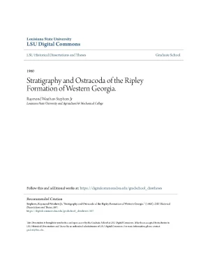
Tải xuống để đọc toàn bộLouisiana State University LSU Digital Commons LSU Historical Dissertations and Theses Graduate School 1960 Stratigraphy and Ostracoda of the Ripley Formation of Western Georgia. Raymond Weathers Stephens Jr Louisiana State University and Agricultural & Mechanical College Follow this and additional works at: https://digitalcommons.edu/gradschool_disstheses Recommended Citation Stephens, Raymond Weathers Jr, "Stratigraphy and Ostracoda of the Ripley Formation of Western Georgia. LSU Historical Dissertations and Theses.edu/gradschool_disstheses/587 This Dissertation is brought to you for free and open access by the Graduate School at LSU Digital Commons. It has been accepted for inclusion in LSU Historical Dissertations and Theses by an authorized administrator of LSU Digital Commons.
For more information, please contact gradetd@lsu. Stratigraphy and Ostracoda of the Ripley Formation of Western Georgia A Dissertation Submitted to the Graduate Faculty of the Louisiana State University and Agricultural and Mechanical College in partial fulfillment of the requirement8 for the degree of Doctor of Philosophy in The Department of Geology by Raymond Weathers Stephens, Jr., University of Georgia, 1951? M, S,, Louisiana State University, 1956 January, I960 ACKNOWLEDGMENTS The writer wishes to express his sincere appreciation to Dr* Glover E. Murray and Dr., Louisiana State University, for their guidance and assistance throughout the preparation of this dissertation and for their time spent with me in both the field and the office* Grateful acknowledgment is due Dr. Howe, Director of the School of Geology, Louisiana State University, far his invaluable assistance in the identification of the Ostracoda and for the generous use of his excellent type collection* Dr.
Fern graciously assisted in the study of the thin sections used in this dissertation and far this the author offers credit and appreciation* Special acknowledgment is due fellow graduate student Steve R. Windham for preparing the Ostracoda illustrations and fellow graduate student Phili Deboo for his aid in mineral identification. The writer is also indebted to the Magnolia Petroleum Company for their graduate fellowship for the years 1957-1959. TABLE OF CONTENTS Page I ABSTRACT.
7 Quitman and Southern Stewart Counties. 8 Northern Stewart, Southern Chattahoochee, and Southern Marion Counties. 12 Central Stewart County. 15 Northern Schley, Southern Taylor, and Northern Macon Counties.
21 Area Between Flint and Ocmulgee Rivers. 21 Cretaceous East of the Ocmulgee River. 35 VII DESCRIPTION OF GENERA AND SPECIES. 37 iii Page Phylum ARTHROPODA.
37 Suborder FLATYCOPA Sars, 1865. 37 Family CYTHERELLIDAE Sars, 1866. 37 Genus CYTHERELLOIDEA Alexander, 1929. 37 Cytherelloidea crafti Sexton,1951.
37 Genus CYTHERELLA Jones, 181*9. 38 Cytherella ovoidea Alexander, 1929. 1*0 Suborder PODOCOPA Sars, 1865. 1*1 Family CYPRIDAE Baird, 181*9.
1*1 Genus ARGILLOECIA Sars, 1866. 1*1 Subfamily CYPRIDINAE Baird, 181*6. 1*1 Genus PARACYPRIS Sars, 1866. Id Paracypris sp.
1*1 Family BAIEDIIBAE Sars, 1923. 1*2 Subfamily BAIRDIINAE Sars, 1923. 1*2 Genus BAIRDOPPHATA Coryell, Sample and Jennings, 193?. 1*2 Bairdoppilata magna Alexander, 1927.
1*2 iv Page Family CYTHERIDAE Baird, 1850. 43 Subfamily XESTOLEBERINAE Sars, 1928.43 Genus XESTOLEBERIS Sars, 1866. 43 Subfamily LOXOCOWCHINAE Sars, 1925. 44 Genus LOXOCONCHA Sars, 1866.
kk Laxoconcha cretacaa Alexander,- 1936. 44 Subfamily CYTHERURINAE Muller, 1894. 45 Genus CYTHEROPTERON Sars, 1866. 45 Genus ORTHONOTACYTHERE Alexander, 1933.
46 Subfamily CYTHERIDEINAE Sars, 1925. 47 Genus CLXTHROCYTHERIDEA Stephenson, 1936. 48 Genus HAPLOCYTHERIDEA Stephenson, 1936. 55 Haplocytheridea ? raybumensis Butler and Jones, Haplocytheridea Barectaensis (Brown), 1957.
57 page Haplocytheridea ? ulrichi (Berry), 1925. 58 Subfamily KRITHINAE Mandelstom, 1958. 59 Genus KRITHE Brady, Crosskey and Robertson, 1874-. 59 Krithe cushmant Alexander, 1929.
59 Subfamily PROGONOCYTHERINAE Sylvester-Bradley, 1948. 60 Genus PR0G0N0CYTHERE Sylvester-Bradley, 1948. 60 Subfamily BRACHYCYTHERINAE Puri, 1953. 6l Genus BRACHYCYTKERE Alexander, 1933.
64 Genus PTERGOCYTHERE Hill, 1954. 65 Subfamily TRACHYLEBERINAE Sylvester-Bradley, 1948. 66 Genus CYTHEREIS Jones, 1849. 66 Cythereis costatana Israelsky, 1929.
• 66 Cythereis communis Israelsky, 1929. 67 Cythereis hazardi Israelsky, 1929. 70 Genus VEENIA Butler and Jones, 1957. 72 Genus AMPHICYTHERURA Butler and Jones, 1957.
74 vi Page New Genus n. Cytherura ? aaratogana Israelsky,1929. 74 VIII LOCATION OF SAMPLES. 76 IX SELECTED BIBLIOGRAPHY.
85 ▼ii LIST OP TABLES Page I Percentages of Minerals Identified in each Thin Section;. 32 II Mean Grain Size, Standard Deviation from Mean, and Observed Range of Quartz Grains in Thin Sections where Quartz Exceeds Ten Percent. 33 III Trace Minerals and Matrix Description of all Thin Sections. 34 viii LIST OF FIGURES 1 Index Hap.
following page 2 2 Check List of Ostracod Species. following page 36 ix LIST OF PLATES I Outcrop Map of Ripley and Providence Formations of Western Georgia. in pocket II East-West Stratigraphic Section, Quitman County, Georgia to Peach County, Georgia (Shows stratigraphic position of ostracod samples and rock thin sections). in pocket III Ostracoda Species.
78 IV Ostracoda Species. 80 x ABSTRACT The Ripley formation (Gulfian) and its bounding formations in western Georgia were studied stratigraphically from the Chattahoochee River on the west to the Ocmulgee River on the east. Surface exposures were measured and described in detail and ostracod samples and rocks for thin sections were collected for study. An outcrop map of the Rip ley formation with the geographic location of the measured sections and a stratigraphic cross section with the position of all ostracod samples and rock thin sections are enclosed in the pocket.
The Ripley extends eastward into Georgia from Alabama and crops out from the Chattahoochee River to the Flint River where it is over lapped by the more northerly striking Providence sand. In western Georgia, the Ripley is composed of a nearshore marl that predominates updip and an offshore fine marine sand and clay that predominates down- dip. The offshore sand and clay extend eastward to the Flint River with very little facies change but thin from approximately 150 feet in the Chattahoochee River valley to approximately 50 feet in the area of the Flint River. East of the Flint River, the Providence sand overlaps the Ripley and lies unconformably upon the Cusseta sand.
In Twiggs County, evi dence suggests that the commercial kaolin is in beds of Cusseta and Providence ages where the Tertiary has overlapped both formations. A total of 37 species of Ostracoda have been found in the Ripley as a result of this investigation. Twenty-seven of these species have been reported previously. Of the remaining 10 species, four are de- scribed as new in this dissertation.
On the basis of the ostracoda, the Ripley of Georgia can be correlated with the Saratoga formation of Arkansas and the Peedee formation of North Carolina. xii INTRODUCTION This stratigraphic study of the Ripley formation developed from an attempt to solva the age and relationships of the pre-Jacksonian sedi ments east of the Ocmulgee River in central Georgia. These sediments have been mostly mapped as Tuscaloosa, but this writer agrees with Eargle (1955) that they represent the entire Upper Cretaceous Series of western Georgia. Because of the difficulty of finding traceable beds and the seemingly uniform lithology of the sediments east of the Ocmulgee River, it is extremely difficult to correlate with the forma tions west of the Ocmulgee.
Additional detailed work is needed on the mere easily mappable units of western Georgia before their eastern correlatives can be readily differentiated. Hoye Eargle (personal communication) kindly suggested at the beginning of this study that the Ripley formation might be a possible key to the problem. The Ripley formation and its bounding contacts were traced from the Chattahoochee River, where the Ripley can be readily identified both paleontologically and lithologically, to the east bank of the Flint River. In the absence of topographic map coverage in most of the area, county road maps were used as base maps and field data were located thereupon.
In addition, the altitudes of all measured sections were recorded with the aid of an altimeter, and were tied in to U. bench narks or other surveyed elevations. The field work for this study was dene between September 1956 and February 1957 and be tween June and September 1957* 1 Topography plays an important role in controlling the stratigraphic and paleont-ologic study of the Ripley of Georgia. The steep bluffs of the rejuvenated Chattahoochee River and adjacent higlands afford the only outcrops with fossil animal remains suitable for faunal study.
East of Buena Vista, Marion County, in an area of mere subdued relief, the sediments have been weathered. The weathering has masked the true lithology and dissolved the shells in the upper beds. Plate I shows the outcrop of the Ripley formation and the Provi dence sand and the location of the measured sections. The outcrop pattern west of the Flint River is after Eargle, 1955 and the outcrop pattern east of the Flint River is modified after Eargle, 1955 as a result of the field work for this dissertation.
Plate II shows the stratigraphic cross section and location and stratigraphic position of the ostracod samples and rock thin sections. Field St udy Fig. 1 STRATIGRAPHY GULFIAN General Features The Gulfian sediments of the Chattahoochee River valley of Georgia are divided into six formations: Providence sand Ripley formation Cusseta sand Blufftown formation Eutaw formation Tuscaloosa formation Langdon (1890, p. 605) in a general section along the Chattahoochee River divided the Cretaceous rocks of the region into Tuscaloosa, Eutaw, and Ripley, from oldest to youngest.
Subsequent investi gation resulted in the Blufftown, Cusseta, and Providence being elevated to formational rank. In 1939, the Georgia Division of Mines, Mining and Geology in co operation with the United States Geologic Survey published the Geologic Map of Georgia. The part of that map dealing with the Coastal Plain was based upon data from a manuscript prepared by C. Cooke's manuscript, "Geology of the Coastal Plain of Georgia," was not published 3 4 until 1943.
The Geologic Map of Georgia shows the Tuscaloosa cropping out from the Chattahoochee River on the west to the Savannah River on the east, the Eutaw and Blufftown formations extending from the Chatta hoochee to Marion County, the Cusseta sand to the Ocmulgee River, the Ripley formation to Macon County, and Providence sand to the Ocmulgee River. Eargle (1955) extended the Eutaw and Blufftown formations to the Flint River and the Ripley formation to the Ocmulgee River; mapped the Eutaw, Blufftown, and Cusseta as undifferentiated between the Flint and Ocmulgee Rivers; mapped all Cretaceous sediments in Georgia east of the Ocmulgee as, "Rocks of Tuscaloosa to Providence age, undifferentiated." In making these changes and extensions, Eargle emphasized the cyclic nature of deposition of the Cretaceous rocks. These cycles or units of these cycles helped him map contacts in the nonmarine facies of Georgia' east of the marine facies in the 8hattahoochee River valley. 5) described the Cretaceous rooks of the Coastal Plain as cyclic deposits most of which begin with coarse sand or gravel, progress upward through fine sand and clay and even chalky clay or chalk, and end with the beginning of another deposit of coarse sediment.
A formation may consist of a complete cycle or one or more units of a cycle. With the exception of the Tuscaloosa, which is nonmarine, all the Upper Cretaceous formations in the Chattahoochee River valley are fossiliferous in the upper beds. Toward the east, each of the formations, with the exception of the Ripley, grade laterally into nearly similar beds of. unfoasiliferous, coarse sand and clay.
The Ripley formation maintains the same general lithology eastward and fossil molds occur at the Flint River where the Ripley is overlapped by the coarse, crossbed ded sand of the Providence. RIPLEY FORMATION General Featvires The Ripley formation was first described by Hilgard (i860, p. 87) from localities near Ripley, Tippah County, Mississippi. Hilgard (i860) designated the Ripley as the sandy oarIs and limestones separating the underlying Cretaceous unit, the Rotten Limestone, from the overlying Northern Ligjaitic, which is Tertiary in age.
The Ripley formation crops out in a narrow belt from the Chatta hoochee River to the Flint River.
Nội dung được bảo vệ bản quyền — Tải xuống đầy đủ
Trích dẫn luận án này
Raymond Weathers Stephens Jr (1960). Stratigraphy & Ostracoda Ripley Formation, Western Georgia [Luận án tiến sĩ, Louisiana State University and Agricultural and Mechanical College]. LuanAn.net. https://luanan.net/khoa-hoc-trai-dat-moi-truong/stratigraphy-ostracoda-ripley-formation-western-georgia
Câu hỏi thường gặp
Luận án "Stratigraphy & Ostracoda Ripley Formation, Western Georgia" nghiên cứu về vấn đề gì?
Luận án: Stratigraphy and ostracoda of the ripley formation of western geo. Xem tóm tắt và tải về tại LuanAn.net
Luận án "Stratigraphy & Ostracoda Ripley Formation, Western Georgia" được bảo vệ tại trường nào?
Luận án này được bảo vệ tại Louisiana State University and Agricultural and Mechanical College. Năm bảo vệ: 1960.
Luận án "Stratigraphy & Ostracoda Ripley Formation, Western Georgia" thuộc chuyên ngành gì?
Luận án "Stratigraphy & Ostracoda Ripley Formation, Western Georgia" thuộc chuyên ngành Geology. Danh mục: Khoa Học Trái Đất & Môi Trường.
Luận án "Stratigraphy & Ostracoda Ripley Formation, Western Georgia" có bao nhiêu trang?
Luận án "Stratigraphy & Ostracoda Ripley Formation, Western Georgia" có 116 trang. Bạn có thể xem trước một phần tài liệu ngay trên trang web trước khi tải về.
Cách tải luận án "Stratigraphy & Ostracoda Ripley Formation, Western Georgia" về máy như thế nào?
Để tải luận án về máy, bạn nhấn nút "Tải xuống ngay" trên trang này, sau đó hoàn tất thanh toán phí lưu trữ. File sẽ được tải xuống ngay sau khi thanh toán thành công. Hỗ trợ qua Zalo: 0559 297 239.